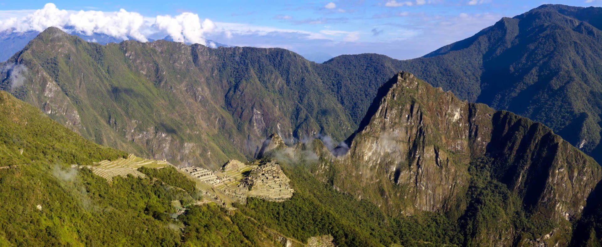
Peru lies just south of the equator on the western side of South America, with the Pacific along its coast and borders with Ecuador and Colombia to the north, Brazil to the east, Bolivia to the southeast and Chile to the south. Inside those borders SENAMHI, Peru’s national weather service, maps 38 different climates, from warm desert to glacier.
The honest answer to “what is the weather like in Peru” starts with where, not when. The country behaves like three: a desert coast where it almost never rains, the Andes with one wet season and one dry season, and the Amazon, hot and wet all year. Altitude does the rest. On an average July day the high is 66°F (19°C) in Lima, 69°F (21°C) in Cusco, where the night then drops below freezing, and 88°F (31°C) in Iquitos.
These are official climate normals from Peru’s weather stations, as published by the World Meteorological Organization and NOAA: 1991–2020 for Cusco, Lake Titicaca and Iquitos, and 1961–1990, the latest available, for Lima, Arequipa and Puerto Maldonado. Highs and lows are the range of the monthly averages.
| City (station) | Altitude | Typical high | Typical low | Rain per year | Wettest months | Driest months |
|---|---|---|---|---|---|---|
| Lima (Lima-Callao, 1961–1990 normals) | 40 ft (13 m) | 66–80°F (19–27°C) | 59–68°F (15–20°C) | 0.25 in (6 mm) | July–August, as drizzle | Almost rainless all year |
| Iquitos, Amazon (San Roque) | 350 ft (106 m) | 88–91°F (31–33°C) | 71–73°F (22–23°C) | 99 in (2,506 mm) | March–May | July–September |
| Puerto Maldonado, Amazon (1961–1990 normals) | 840 ft (256 m) | 84–90°F (29–32°C) | 62–71°F (17–21°C) | 85 in (2,167 mm) | December–February | June–August |
| Arequipa (1961–1990 normals) | 8,280 ft (2,525 m) | 71–76°F (21–25°C) | 41–48°F (5–9°C) | 3.8 in (97 mm) | January–March | April–November |
| Cusco (Granja Kcayra) | 10,540 ft (3,214 m) | 68–72°F (20–22°C) | 30–46°F (−1 to 8°C) | 26 in (666 mm) | December–March | May–August |
| Lake Titicaca, north shore (Moho) | 12,590 ft (3,836 m) | 57–62°F (14–17°C) | 29–41°F (−2 to 5°C) | 32 in (806 mm) | December–March | May–August |
Read down the table and the three Perus appear. The coast barely gets rain. The Amazon gets it every month. The Andes get it in one season, and the higher you go, the colder the nights.

Peru’s coast is a narrow desert between the Pacific and the Andes Mountains, broken by fertile river valleys. SENAMHI names three reasons it stays dry: the high-pressure system over the South Pacific, the cold Humboldt Current offshore, and the western wall of the Andes. Together they stop rain clouds from growing.
Lima is one of the largest cities in the world built in a desert, with 6–8 mm of rain a year depending on the station, about a quarter of an inch, nearly all of it drizzle. If you want the coast warm, come between December and March, when Lima’s highs reach 76–80°F (24–27°C).
The rest of the year is a different coast. From June to September a low, grey cloud deck settles over much of the shore, and the drizzle that falls from it is the garúa: very fine droplets that can fall for hours, mostly from June to August. It hardly registers in a rain gauge. You notice the grey and the damp instead. Lima’s highs sit at 66°F (19°C) from July to September, and the winter humidity makes it feel colder near the sea.
The north coast runs warmer: highs reach 79°F (26°C) in February and March at Trujillo, near Chan Chan, and 93°F (34°C) in Piura, which also gets 9 inches (235 mm) of rain a year, mostly from January to April. Dry and sunny all year is too simple for the north.

Peru is in the southern hemisphere, so winter is June to August, starting around June 21. In the Andes, though, the calendar that matters is rain. Cusco’s average high stays between 68°F and 72°F (20–22°C) in every month. What changes is how wet it is and how cold the nights get. Machu Picchu has its own Machu Picchu weather guide.
SENAMHI counts September to November as the start of the rainy season across much of the highlands, and it builds from there. In Cusco, December to March each bring 3.8 to 5.7 inches (97–146 mm), and January is the wettest month, as it is at Lake Titicaca. Arequipa, lower and drier, gets less than 4 inches (97 mm) a year, nine-tenths of it from January to March.
From May to August the Andes dry out almost completely. Cusco gets less than a quarter of an inch (4–6 mm) a month, and Lake Titicaca’s north shore about a quarter of an inch (6–7 mm) in June and July.
You may read that the Andes have their summer from April to October. Half right. April to October is the drier half of the year, driest from May to August, but it spans the southern winter, and the days do not warm up: Cusco’s highs are 69–71°F (21–22°C) from May to August. For which month suits your plans, see the best time to visit Peru.
The days stay mild. The nights do not. Cusco’s average low falls from 46°F (8°C) in February to 30°F (−1°C) in July. On the north shore of Lake Titicaca, July nights average 29°F (−2°C), and SENAMHI notes the lake softens the temperature along its shores. A short way inland, at Juliaca on the high plain west of the lake, the July average low is 19°F (−7.5°C), and SENAMHI reports frequent autumn and winter snow at nearby Cabanillas.
In the Colca valley, Chivay’s nights drop to 29°F (−2°C) in June and July.
Almost 60% of Peru is forest, and 94% of that forest is in the Amazon, according to Peru’s environment ministry. Here the heat is constant. Iquitos sees highs of 88–91°F (31–33°C) in every month, and even July, its driest, gets 5.2 inches (132 mm) of rain. The river there runs highest from March to May and lowest from August to October, which shapes an Amazon river cruise more than the temperature does.
Puerto Maldonado, in the southern Amazon, has a sharper split: January alone brings 13.5 inches (343 mm), while June to August get 2.2–2.5 inches (57–63 mm) a month. The south also takes the cold snaps. SENAMHI counts 6 to 10 friajes a year, cold air that enters Peru through the southern jungle, mostly in autumn and winter, for 3 to 7 days. Highs can fall from 95°F to 72°F (35°C to 22°C) and nights to about 52°F (11°C), so pack a warm layer for an Amazon rainforest trip in those months. More on the rainforest’s seasons is in our Amazon rainforest weather guide.
The normals are averages, and some years break them. In an El Niño, warm water replaces Peru’s usually cold sea, raising air temperatures on the coast and bringing heavy rain, above all to the north coast in the southern summer. The extreme events of 1983 and 1998 brought destructive floods to the coast, and 1983 also brought severe drought to the southern highlands. La Niña years tend to run the other way, with more rain than normal across the country.
ENFEN, Peru’s national El Niño commission, publishes the current alert status. If your trip falls in an El Niño summer and includes the north coast, leave some slack in the plan.
Pack for three climates in one bag: light, quick-drying clothes for the Amazon and the summer coast, a sweater for Lima’s grey winter, real warm layers for Cusco, Lake Titicaca and the Colca, and a rain jacket for the Andes from December to March and for the Amazon in any month. The rest is on our Peru packing list.
If your route crosses all three climates, share your dates when you ask about a custom Peru trip, so the seasons shape the order of the route from the start. Or browse our Peru tours.





