Chile runs 4,270 km (2,650 mi) north to south, across 39 degrees of latitude, with Peru and Bolivia to the north and Argentina to the east along the Andes Mountains. Its coastline on the South Pacific Ocean measures 6,435 km (4,000 mi). The climates are split into regions by latitude: the extreme desert in the north, a temperate Mediterranean climate in the center near Santiago, and a cool, damp south that ends in Patagonia.
So there is no single temperature for the country. Ask where first, then when. Chile’s seasons run opposite to North America’s, and July is the coldest month at every mainland station below. For when to go, see the best time to visit Chile.
These are the 1991–2020 climate normals from the Dirección Meteorológica de Chile (DMC), the national weather service, reported to the World Meteorological Organization.
| City (DMC station) | Altitude | January high / low | July high / low | Rain per year | Wettest month | Driest months |
|---|---|---|---|---|---|---|
| Calama, Atacama Desert (El Loa airport) | 7,630 ft (2,326 m) | 77 / 44°F (25 / 7°C) | 70 / 31°F (21 / 0°C) | 0.3 in (7 mm) | None to speak of | October–December (none) |
| Santiago (Quinta Normal) | 1,710 ft (520 m) | 87 / 56°F (30 / 14°C) | 60 / 39°F (16 / 4°C) | 11.3 in (286 mm) | June | January–March |
| Valparaíso (Rodelillo aerodrome) | 1,080 ft (330 m) | 74 / 54°F (23 / 12°C) | 59 / 45°F (15 / 7°C) | 20.6 in (524 mm) | June | January–February |
| Puerto Montt, Lake District (El Tepual airport) | 300 ft (90 m) | 68 / 49°F (20 / 9°C) | 50 / 38°F (10 / 4°C) | 61.6 in (1,566 mm) | June | January–February |
| Punta Arenas, Patagonia (Carlos Ibáñez airport) | 140 ft (43 m) | 60 / 44°F (15 / 7°C) | 40 / 31°F (4 / −1°C) | 15.3 in (389 mm) | April | September–November |
| Easter Island (Mataveri airport) | 230 ft (69 m) | 80 / 68°F (27 / 20°C) | 70 / 61°F (21 / 16°C) | 44.5 in (1,130 mm) | April | December and February |
Read down the rain column. It climbs from almost nothing in the desert to more than 60 inches in the Lake District, then falls again in Patagonia.

In the north, the dry Atacama rests: the driest desert in the world. Arica, on its coast, averages less than a tenth of an inch of rain a year (2.2 mm), on fewer than one day.
The desert is not hot, though. It is dry and high. At Calama, the closest official station to San Pedro de Atacama, the average high stays between 70 and 77°F (21–25°C) in every month. What changes is the night. The temperature falls by an average of 32°F (18°C) from afternoon to dawn in January and 39°F (22°C) in July, when the average low is 31°F (0°C). Pack for both ends of the day on Atacama Desert tours.
One exception: the DMC describes afternoon storms over the high Andean plateau in the southern summer, which in some years spill into San Pedro de Atacama and Calama as isolated showers. The coast is calmer. In Arica, highs run 65–79°F (18–26°C) through the year and nights 58–68°F (15–20°C).
Chile’s central region has a Mediterranean climate, with a rainy season from May to August. In Santiago those four months bring 76% of the year’s 11.3 inches (286 mm) of rain. January to March together bring less than a quarter of an inch (6 mm).
Summer in Santiago is hot and bright: January averages 87°F (30°C) in the afternoon and 56°F (14°C) at night, with more than ten hours of sunshine a day. Winter is cool rather than cold, 60°F (16°C) by day and 39°F (4°C) at night in July, with under four hours of sun a day in June. For the vineyards around the capital, see our Chile wine tours.
On the coast, Valparaíso averages 74°F (23°C) in January, 13°F (7°C) cooler than Santiago, and gets almost twice the rain, most of it from May to July.

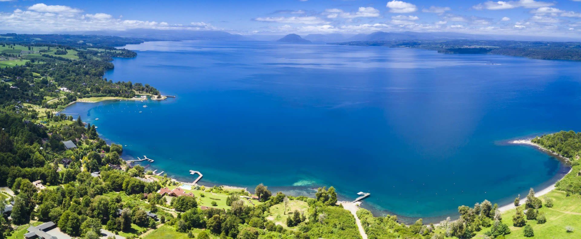
South of the central valley, the rain takes over. Puerto Montt gets 61.6 inches (1,566 mm) a year on about 170 days, close to every other day. June brings 8.4 inches (213 mm) on 19 days, with less than two hours of sunshine a day. Even February, the driest month, brings 2.7 inches (69 mm). Valdivia, farther north, is wetter still at 67.8 inches (1,722 mm).
Summer is the kind season: January averages 68°F (20°C) by day and 49°F (9°C) at night, with 7.7 hours of sunshine a day. July is raw, 50°F (10°C) and 38°F (4°C). Plan Lake District tours with rain in mind in any month.
Punta Arenas, at 53° south, is cool all year: 60°F (15°C) on an average January afternoon and 40°F (4°C) in July, when the average low dips to 31°F (−1°C). It gets less rain than Valparaíso, 15.3 inches (389 mm), but on 86 days, spread so evenly that every month sees 0.9–1.8 inches (23–45 mm). December averages seven and a half hours of sunshine a day, June under two and a half.
Wind is the other half of the Patagonia story, and these averages do not show it. Our Patagonia weather guide covers the wind and the trekking season. Pack a windproof layer in any season, above all for a Torres del Paine trip.
Easter Island, far out in the Pacific, has a climate of its own: warm all year, and wet in every month. Average highs run 70–82°F (21–28°C), and the average low never drops below 60°F (16°C). Rain falls on about 126 days, 44.5 inches (1,130 mm) a year. April and May are wettest, but there is no dry season, so an Easter Island tour works in any month with a rain jacket in the bag.
The normals are averages, and some years stray far from them. According to the DMC, an El Niño year usually brings central and southern Chile wetter winters and springs and warmer temperatures. Under La Niña, springs tend to be quite dry, especially between Curicó and Puerto Montt. If your trip falls in a strong El Niño or La Niña year, expect the season to run wetter or drier than the table, and leave some slack in the plan.
If you’re visiting the cities in summer, pack lightweight, neutral-colored clothes for Santiago’s hot afternoons. Then add layers, because the nights are much cooler than the days almost everywhere: a warm jacket for the Atacama, where winter nights average below freezing, and a sweater for Santiago in July. During the wet season, be sure to pack waterproof gear, as the rain does come down hard; in the Lake District and Patagonia, pack it in every season. The rest is on our Chile packing list.
If your route runs from the desert to the south, share your dates when you ask about a custom Chile trip, so the climate shapes the order of the route from the start. Or browse our Chile tours first.





